
🗺️ Accessing charts
When flying on VATSIM, it is very crucial to have charts on board. Charts contain important information such as navigation aids, airport layouts, and instrument procedures. They assist you so that you can follow ATC instructions correctly and as intended.
This page covers two methods to obtain latest charts for Thailand: via the Aeronautical Information Publication (AIP) - free, and via commercial services (paid).
AIP Thailand - free
The AIP for Thailand is accessible at no cost via the link below:
https://aip.caat.or.th/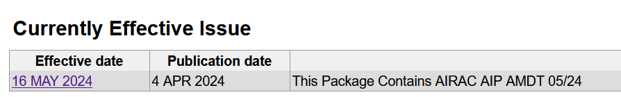
After accessing the link above, click on the date under "Currently Effective Issue".
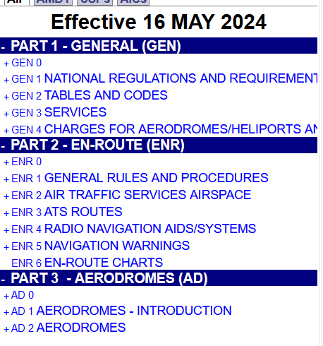
You will be presented with another screen. On the left sidebar, under "PART 3 - AERODROMES (AD)", press on "AD 2 AERODROMES".
A list of airports will appear. Simply find the intended airport in the list, then click on it.
Scroll down to the bottom of the page to find all charts related to the selected airport.
Commercial services - paid
There are companies which offer access to different aeronautical chart providers. As alluded above, they are not free and are almost certainly subscription-based. However, one of their advantages is that they provide a single unified format for all available airports and AIP providers, which is easy to understand.
Two of the most popular services in the flight simulation community are as follows:
Thailand vACC makes no recommendations on the service to use - this listing is for informational purposes only.